4 Weeks of Hiking in Italy Along a Historic Pilgrim Trail
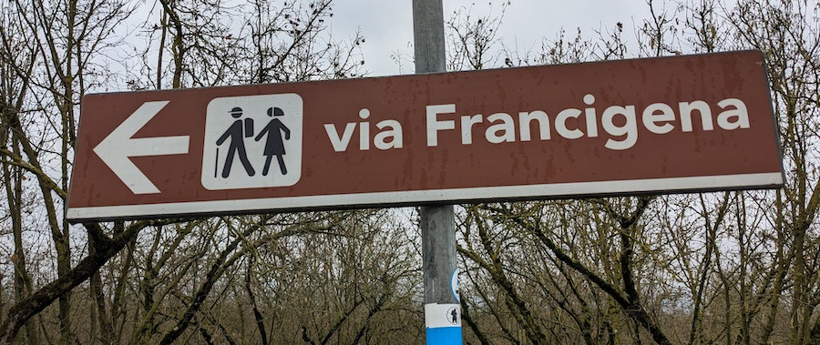
We were so taken with our initial impression of the Via Francigena pilgrim trail in Tuscany that we returned to hike additional sections of the trail over three more trips. So far, we’ve covered 22 of the 25 final stages between Pontremoli and Rome (including Lucca, Siena, Viterbo, and more). I’ve detailed the best 7-day section of the trail in my separate highlights of the Via Francigena post, so this post will focus on the remaining stages, broken into four sub-sections (listed from northernmost to southernmost, ending in Rome):
Section 1: PONTREMOLI to LUCCA - 5 stages - 129km (80 miles)
Section 2: LUCCA to SIENA - 6 stages - 135km (84 miles)
Section 3: SIENA to VITERBO - 7 stages - 165km (103 miles)
Section 4: VITERBO to ROME - 5 stages - 118km (73 miles)
Of these, the final three weeks (Lucca to Siena/Siena to Viterbo/Viterbo to Rome) are the most picturesque and packed with many interesting sights. The first week described here (Pontremoli to Lucca) has a much more off-the-beaten-track feel, where you’ll trade crowds and well-known sights for undiscovered gems spread slightly farther apart. If you’re short of time, I’d recommend prioritizing the sections between Lucca and Rome.
I’ll leave it to Sandy Brown and his excellent hiking guide Walking the Via Francigena Pilgrim Route - Part 3 to provide you with all the details of the trail, accommodations, etc. For tips on food, accommodations, practicalities, food, equipment, and weather, please refer to my highlights of the Via Francigena post. The basics are all the same here, with stages in this post numbered Section 1/Day 1, etc. Finally, I recommend the free, official Via Fracigena app with detailed maps as well as information on accommodations and points of interest.
Note: we covered these sections in late October and over New Year’s over two years. Even in the dead of winter, we found the weather quite mild and even found ourselves hiking in short sleeves at times in January. Mornings and evenings were chilly, but generally, this low-altitude section of the trail seems to be a good bet for hiking any time of year for hardy hikers.
So, let’s get started with the first sub-section:
Section 1 OVERVIEW: PONTREMOLI TO LUCCA Total 129 km (80mi)
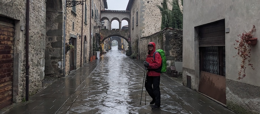
This section of the Via Francigena is a hiker’s dream, with longer walking stretches between points of interest. It feels way, way off the beaten tourist track — much more so than the sections between Lucca and Rome. (Having said that, most of the Via Francigena feels blissfully off the beaten track, but you will pass through many tourist hotspots farther south — Lucca, San Gimigiano, Siena, etc). The 5-day section from Pontremoli to Lucca, on the other hand, takes you through many unspoiled gems you’ve probably never heard of before. None are hugely superlative in and of themselves, but we fell in love with their quiet, authentic charms and loved only having to share them with locals. What a treat!
Section 1/Day 1: PONTREMOLI TO AULLA - 32km (20mi)
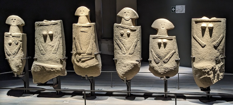
Pontremoli is easy to reach by train with only one or two connections from major hubs like Rome, Bologna, or Florence. Pontremoli is well worth spending a few hours in, so it makes sense to arrive the evening before you set off hiking or to arrive as early as possible and shorten the first hiking day with an additional overnight stop in Filatierra (11km/7mi in). That way, you can take in Pontremoli’s dramatic riverside setting, bridges, cafés, and castle/museum with its fascinating Iron Age stelae before hitting the road.
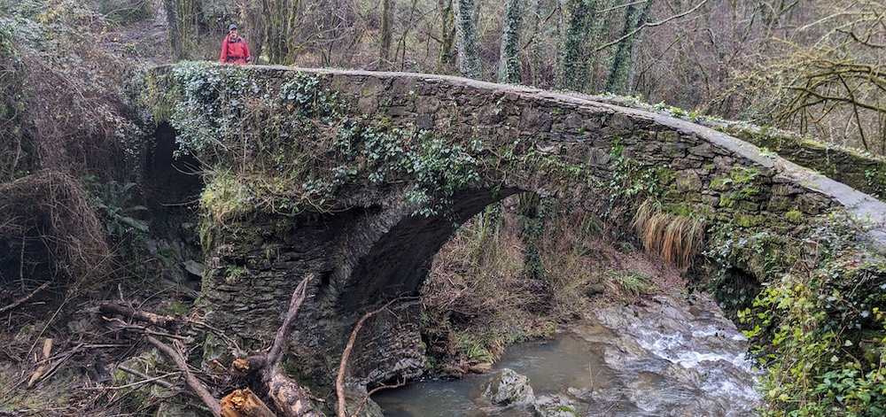
Highlights of this hilly stage include the 12th century church of Pieve di Sorano (at km 11) in Filattiera, the pretty towns of Filattiera Alto and Virgoletta (both good lunch stops with a few shops), and the beautiful old bridge over the Torrente Carpena (26km/16mi). Sadly, WWII allied bombings obliterated Aulla, which retains nothing of its original character. However, they Abbey of San Caprasio has been largely restored and houses an interesting museum.
The only option for an overnight/dinner at Filatierra is the Antica Pieve, right across the street from the lovely 12th century Pieve di Sorano church (and under the same roof as the handy Pizzeria Locanda Antica Pieve). There are many places to stay in Aulla, from comfortable AirBnBs to the pilgrim hostel in the San Caprasio Abbey.
Section 1/Day 2: AULLA to SARZANA - 17km (11mi)
This is a relatively short but hilly day with 900m ascent and descent. You’ll spend long stretches in forests and end the day with views of the Ligurian Sea in the distance (that’s the section of Mediterranean between Corsica/Sardinia and mainland Italy).
Bibola, located in the early part of this stage, is a tiny, crumbling hilltop village complete with castle ruins that turned out to be one of our favorite spots along the 500km of Via Francigena that we’ve covered to date. You’ll have beautiful views of the Apennines and eventually emerge from the woods near Ponzano Supperiore, where a small café offers a good spot for a snack lunch break. The day ends in lovely Sarzana with its pleasant old town steets, historic fortezza, and cathedral.
I was unable to make contact with the pilgrim hostel listed in Sandy Brown’s hiking guide, but we were delighted with the palacial La Foresteria di Palazzo Picedi Benettini we booked in the center of the old town.
Section 1/Day 3: SARZANA to MASSA - 29km (18mi)
This stage has long stretches of pleasant walking punctuated by two main points of interest: the Roman ruins of Luni at km 12 (supposedly sacked in the ninth century by Vikings who mistook the large city for Rome!), and second, the pleasant town of Avenza at km 17 (with a fortress/tower, many cafés, and views up to the Carrara marble quarries on your way out of town). Parts of the trail are a little tedious, but one section follows a pleasant, winding canal and another offers fabulous views of the Ligurian Sea.
Massa did not look promising from a distance, but we were sold on its charms the moment we entered the historic old town with its excellent pilgrim hostel (Ostello Palazzo Nizza on Piazza Mercurio).
Section 1/Day 4: MASSA to CAMAIORE - 26km (16mi)
This is more of a “cruise along in your thoughts” hiking day than one packed with superlative sights, but that was part of the charm as far as we were concerned. You’ll pass a castle (Castello Aghinolfi after 6km), a nice café in Strettoia, and more cafés/eateries plus a cathedral in Pietrasanta. The last section of trail into Camaiore parallels a busy road, but you’ll be hiking on a separate trail alongside the river which makes for pleasant going.
Camoire is a lot like Sarzana and Massa — a nice old town with an unspoiled, local vibe. There is a pilgrim hostel there along with many choices of private accommodations bookable throughAirBnB and Booking.com.
Section 1/Day 5: CAMAIORE to LUCCA - 25km (16mi)
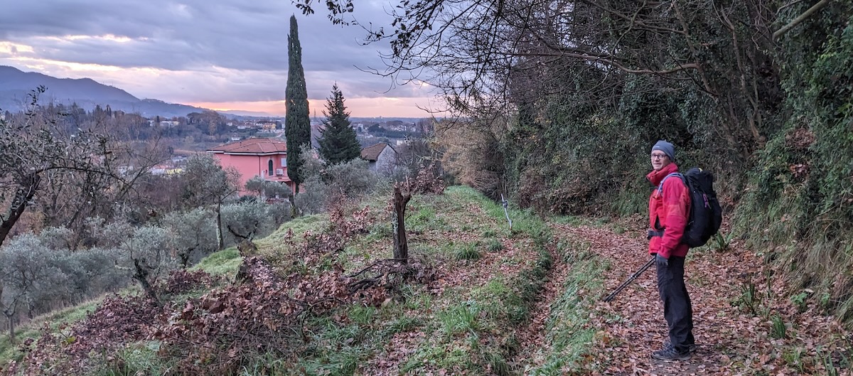
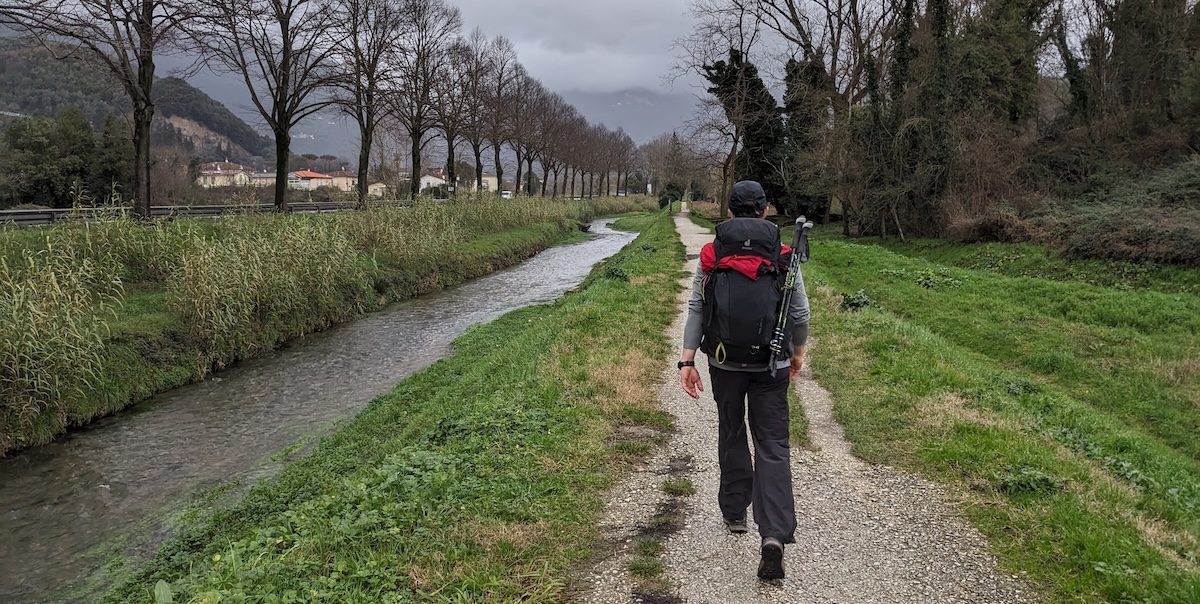
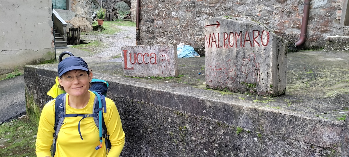
This was the hilliest day of the Pontremoli to Lucca section of the VF — and the most poorly signed. We lost the trail described in Sandy Brown’s hiking guide and ended up taking an alternative route over Monte Ghilardona with its beautiful hilltop church. Very hilly and very pretty! We rejoined the main trail in Valpromaro, then endured a long stretch along a road (not dangerous but unpleasant with occasional high-speed cars). Much nicer were the last few km along a quiet riverside trail into Lucca.
Section 2 OVERVIEW: LUCCA to SIENA - 6 stages - 135km (84 miles)
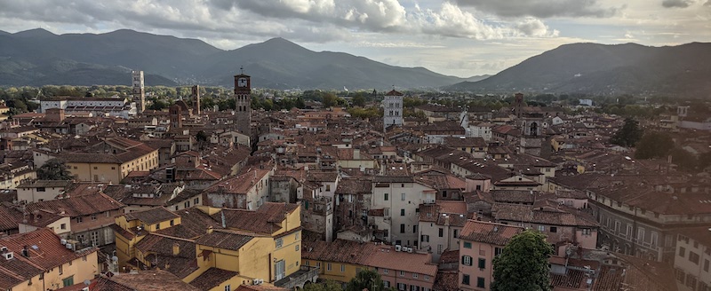
Lucca is a must-see historic city and easily reached from Florence by train (twice hourly, 90 minute ride, approx. €8), but it is packed with tourists. Still, there’s a lot to love if you avoid the main east-west drag through the middle of town. Highlights include the Duomo of San Martino, the Piazza Anfiteatro, which echoes the shape of the Roman arena that originally occupied this space, and 4km of unbroken city walls. I especially enjoyed the treasure hunt aspect of the Church of San Frediano — can you find the (poorly marked) tomb of pilgrim Richard of Wessex, a nobleman who died in Lucca in 722?
All in all, Lucca is the perfect place to start a Via Francigena hike.
Section 2/Day 1: LUCCA to ALTOPASCIO - 18km (11mi), easy
Many hikers use a 10 minute train ride to skip this section based on Sandy Brown’s description of it as a flat day “of roadside walking, often accompanied by the noise of trucks and speeding cars.” Whether you hike it or not, plan to spend some time in lovely, underrated Altopascio with its historic church, pilgrim hostel, and medieval town center.
Section 2/Day 2: ALTOPASCIO to SAN MINIATO - 29km (18mi), easy except for length
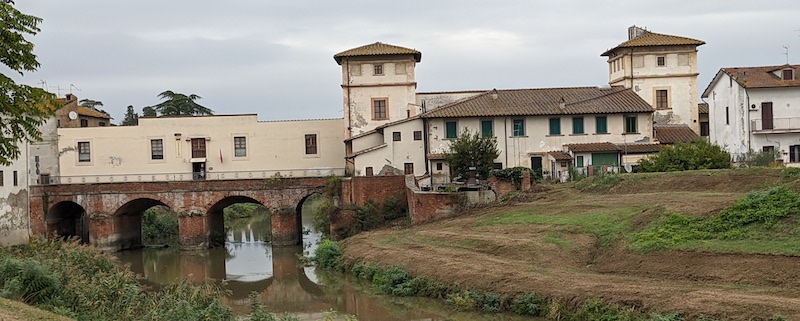
This is a long stage which is pleasant, but lacking in memorable scenery. Some hikers break up the long stage with a stop in historic Ponte a Cappiano, where pilgrims have used the bridge as a river crossing for centuries. I enjoyed the intense sense of history of this place and loved the idea of staying in the historic pilgrim hostel built directly over the bridge — until I read bitterly negative reviews of the place, so we gave it a miss.
There are a few small, appealing towns along the way, but the most memorable section of this stage are the last kilometers into San Miniato, where a hilltop tower guides you in like a beacon. Stop for supplies in the supermarket at the base of the hill before climbing to the old town of San Miniato with its historic Franciscan monastery, an incredible place to stay.
Section 2/Day 3: SAN MINIATO to GAMBASSI THERME - 24km (15mi), moderate
A nice day of walking that ends with a recommended stay in the historic Ostello Sigerico. See Day 1 of my highlights post for details.
Section 2/Day 4: GAMBASSI THERME to SAN GIMIGNANO - 14km (9mi), easy
This short hike through idyllic Tuscan scenery leaves plenty of time to explore this unique medieval town. See Day 2 of my highlight post for details.
Section 2/Day 5: SAN GIMIGNANO to MONTERIGGIONI - 28km (17mi), easy except for length
One highlight of this leg is the historic Abbadia d’Isola; the stage ends in amazing Monteriggioni, where we recommended staying in the historic pilgrim hostel. See Day 3 of my highlights post for details.
Section 2/Day 6: MONTERIGGIONI to SIENA - 22km (14mi), moderate
An easy-going day ending in must-see Siena, one of several city-states that dominated medieval Tuscany. See Day 4 of my highlights post for details.
Section 3 OVERVIEW: SIENA to VITERBO - 7 stages - 165km (103 miles)
This brings us to the next sub-section of the Via Francigena from Siena to Viterbo. It also completes the Tuscan section of the Via Francigena and ushers hikers into the Lazio region.
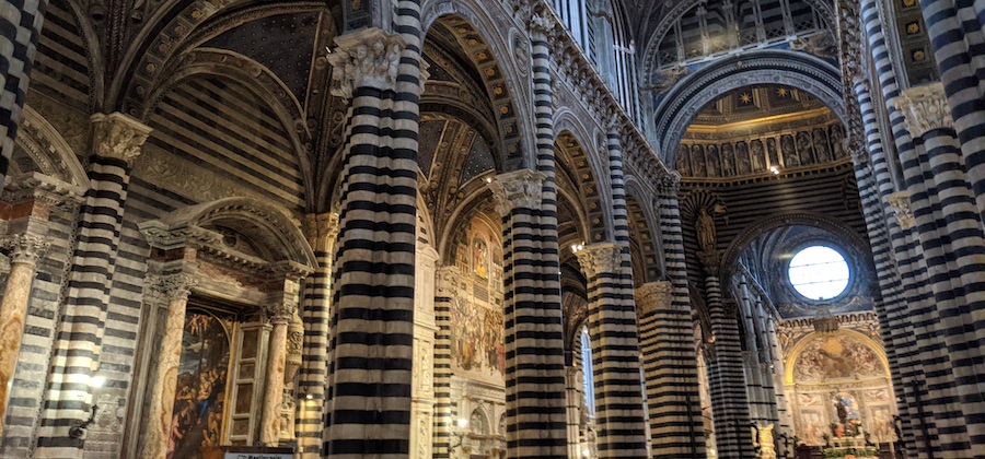
Siena is a great place for a rest day, with time to learn about the city’s 17 neighborhoods, each with its own mascot and civic pride. Visit highlights like the Piazza del Campo, Duomo, and Palazzo Pubblico, as well as lesser-known gems like the modest Chiesa di San Pietro alle Magione on the way into town. This 10th century Romanesque church was built by the Knights Templar and later run by the Knights of Malta, who hosted pilgrims in an adjoining building for centuries.
Section 3/Day 1: SIENA to BUONCONVENTO - 30km (19mi), easy except for length
This is a slightly less scenic stage ending in lovely Buonconvento. See Day 5 of my highlights post for details.
Section 3/Day 2: BUONCONVENTO to SAN QUIRICO D’ORCIA - 22km (14mi), moderate
This stage is bookended by two lovely towns with great scenery in between. See Day 6 of my highlights post for details.
Section 3/Day 3: SAN QUIRICO D’ORCIA to RADICOFANI - 33km (20mi), strenuous
This is a long, strenuous day of stunning scenery, with most of the highlights coming in the first few kilometers. See Day 7 of my highlights post for details.
Section 3/Day 4: RADICOFANI to ACQUAPENDENTE - 23km (14mi), moderate
From Radicofani, it’s mostly downhill to Acquapendente, and you’ll leave Tuscany for Lazio (another of Italy’s administrative regions). Happily, the downhill isn’t too steep, making for a scenic, pleasant hike. Centeno at approx. 15km is a tiny hamlet just off the main road where Galileo stayed in 1633. That’s interesting in the big-picture context, as he was on his way to Rome to face the Inquisition who were none too pleased about his revolutionary Heliocentric model of the universe. The plaque on the building isn’t interesting in itself, but if you picture Galileo resting here, wondering/worrying about what lay ahead… Well, it certainly made an episode of history more meaningful to me.
From Centeno, the “trail” is the busy highway, which we had no desire to risk. We decided to skip that section and waited for a bus instead (and ended up being offered a ride by a local). I definitely had mixed feelings about this: “guilt” for “cheating” versus sheer relief not to have to dodge cars and trucks for 7km!
Acquapendente is a little on the gritty side, worlds apart from some of the pretty, quiet villages we were treated to along the hike. However, we enjoyed the real-life feel of historic buildings and modern life blending there. And we loved enjoying it all from the gorgeous rooftop terrace of our accommodation, Alloggio 76.
Section 3/Day 5: ACQUAPENDENTE to BOLSENA - 23km (14mi), moderate
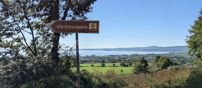
This is a mellow, easy day, first through flat fields and later, along pleasant woodsy trails. As you depart San Lorenzo Nuovo (the perfect place for a snack stop), you crest a rise where the sparkling waters of Lago di Bolsena come into view. The lake is Europe’s largest volcanic lake, with water collecting in the collapsed crater. The trail eventually leads to the castle in Bolsena’s historic district, then meanders down to the pretty, newer town below. This lakeside town is a great place to spend a rest day.
Section 3/Day 6: BOLSENA to MONTEFIASCONE - 16km (10mi), moderate
A mostly uphill stage to an interesting, historic city with views of the lake most of the way. This is one of three stages I have not completed, so I will leave it to Sandy Brown to describe in his excellent guide book.
Section 3/Day 7: MONTEFIASCONE to VITERBO - 18km (11mi), easy
You’ll lose a lot of altitude over this stage, gradually descending to Viterbo. Working off Sandy Brown’s description of the route as “nerve-wracking among speedy cars and trucks into the grimy side of workaday Viterbo,” we decided to skip this section of the VF as time was limited. However, Viterbo itself is a fascinating town with a history that goes back to Etruscan times. It’s known for the annual Macchina di Santa Rosa procession on September 3rd. The macchina is a 30 meter tall tower maneuvered by one hundred men through Viterbo’s narrow streets and squares. Quite a sight! Of interest throughout the year is the Palazzo dei Papi, Papal seat for 24 years in the 13th century.
Section 4 OVERVIEW: VITERBO to ROME - 5 stages - 118km (73 miles)
This brings us to the final, memorable section of the Via Francigena from Viterbo to Rome. Nothing beats the feeling of entering the Eternal City after days of walking, and the hilltop views truly make the entrance a grand occasion. The landscape over these five days may not be as stunning as in Tuscany, but it did have its own appeal, and we enjoyed passing through many small towns — and hidden pockets of nature — along the way.
Section 4/Day 1: VITERBO to VETRALLA - 18km (11 mi), easy
Leaving Viterbo through the imposing city gates will leave you with strong memories, as will walking through several “sunken roads” known as via cave along the way. These date back to Etruscan times, and their purpose/creation remains a mystery to this day.
Then comes a long stretch of easy-going hiking with a nice rest stop/picnic area along the way. Eventually, you’ll reach Vetralla, one of those wonderful Via Francigena towns with a lovely, genuine feel without specific highlights that draw tourists. We loved wandering the crooked streets of the old town and catching glimpses of “real life” in Lazio.
Section 4/Day 2: VETRALLA to SUTRI - 25km (16 mi), moderate
Like most of the remaining stages into Rome, this leg surprised us with long stretches of quiet, nature zones, including a lovely forest and hazelnut groves. You’ll pass the ruins of the misnamed “Orlando” towers (they’re not related to legendary 8th century hero Roland), then pass through lovely Capranica, the perfect place for a lunch break.
Departing Capranica via a long, winding stairway, you’ll enter a valley and eventually follow a pretty stream/gorge into Sutri. There’s a huge area of well-preserved Etruscan ruins at the base of the hilltop town, as well as a Roman amphitheater cut right into the natural stone. Sutri itself is a lovely maze of streets and old buildings, the perfect place for a relaxed overnight stay.
Section 4/Day 3: SUTRI to CAMPAGNANO DI ROMA - 29km (18 mi), moderate
This stage isn’t blessed with superlative scenery, but we found the walking pleasant enough on the longer option described in Sandy Brown’s book (thus making the day 29km instead of 27). Highlights include the artisan bakery in Monterosi and the pretty waterfall and ruins of a mill at Monte Gelato. The last few kilometers through a quiet valley offer imposing views of hilltop Campagnano di Roma at the end of the stage. You’ll pass through the medieval part of town first, then transition to the 18th/19th century section with its ornamental gates. Campagnano, like Vetralla and others, isn’t packed with superlatives, but it’s still a pleasant place to spend an evening.
Section 4/Day 4: CAMPAGNANO DI ROMA to LA STORTA - 24km (15mi), easy
Being a day away from Rome will put a spring in your step as you tackle this easy, penultimate stage of the Via Francigena. Signs lead you out of town and into pretty Veio Park, part of Rome’s green belt. You’ll hike through woods and glimpse historic Santuario del Sorbo along the way.
At the 9km mark of the day comes Formello, a pretty town with a truly special hidden gem. That’s the spiral staircase the winds up a tower beside the archaeological museum in the castle in the very center of town. Ask the museum personnel to point you to the not-too-obvious doorway to that staircase (part of the pilgrim hostel which is now closed). Every step is made of glass and etched with the name of a stop along the Via Francigena, starting with Canterbury and ending with Rome at the top. For us, it was a wonderful, sentimental opportunity to look back on all the stages we covered and anticipate what lay ahead. I can only imagine what feelings a pilgrim who comes all the way from Canterbury experiences on these stairs! There’s also a nice view over the rooftops of Fornello from the top of this tower.
Departing Fornello, you’ll walk over rolling hills with wide open views that hardly hint at a huge city lying not far away. We enjoyed Sandy Brown’s “shortcut” route to Isola Farnese, although the Etruscan ruins along the way leave a lot to the imagination. We reserved a room in a hotel in the historic part of Isola Farnese, with its castle and 15th century church, but with no dinner options there, continuing on to accommodations in La Storta would have been a better choice. (Luckily, pizza delivery saved us in the end!) La Storta is an unappealing commercial town but it’s a practical place for an overnight stay.
Section 4/Day 5: LA STORTA to ROME - 20km (12mi), easy
The first, long section of this day leads you along a busy road where VF signs are few and far between, creating some confusion, so keep on eye on your map or the app. Thus, it was with great relief that we finally entered peaceful Insugherata Nature Reserve which leads to the outskirts of Rome. After a few kilometers on the pavement in the outer parts of the city, you’ll catch a last breath of calm in the Monte Mario Nature reserve. That’s a wooded, hilly area, and the viewpoint it opens up to provides a truly breathtaking way to enter Rome.
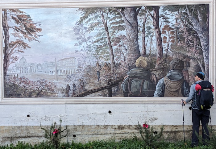
You’re high above the city there, with views over the nearby Vatican with St. Peter’s dome, not to mention the rest of Rome with its seven hills and countless church towers. We spent a long time savoring the view here and thinking of our journey before descending into Rome proper. Once down in the city, it’s a bit of a plod over the last few kilometers to the Vatican, but what a sense of accomplishment you’ll feel once standing there!
RESOURCES & EQUIPMENT
I’ve detailed equipment, accommodations, food, and weather in my highlights of the Via Francigena post, so navigate there for tips on what to bring as well as resources for learning more about the Via Francigena and medieval pilgrimage in general.
I hope this has been helpful and interesting, either as a planning tool or armchair adventure. For other exciting trips and ideas, click on “HOME” at the top of the page. Thank you for visiting TheTravelBug.blog and happy travels!
