Hiking Hadrian’s Wall
A six-day hike across northern England along the line of this well-preserved Roman fortification.
This walk combines countryside scenery with history and follows the Roman Empire’s northernmost frontier as established in the second century AD. Many sections of Hadrian’s Wall are incredibly well preserved, making it easy to imagine standing watch in a Roman lookout tower, keeping an eye out on unconquered territory populated by pesky Caledones to the north.
The main challenge of this trail is the distance you choose to cover rather than the moderately undulating terrain, making it a trail suitable for all ages, especially if you factor in the easy availability of luggage transport services.
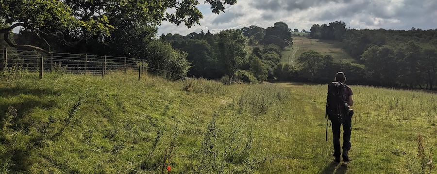
While this six-day, 135 km (84 mi) trail follows the route of Hadrian’s Wall, you’ll only see significant ruins on days 3 and 4 (long stretches of wall, forts, watch towers, Roman bridges). Those are also the most scenic and challenging days where the wall follows a rolly, rocky ridgeline. (Even so, elevation gains on those days are only 300 and 500m). So, Days 3 and 4 are definitely the highlights. If you are short on time, you won’t miss much of the wall experience if you only focus on those two legs. However, there’s plenty of pretty English countryside to soak in throughout the walk (pun intended), as well as a ramble along the Tyne river on the last leg of the journey. All in all, I loved the ruins, enjoyed the scenery, and relished the mental down time of a week of hiking.
ABOUT THE WALL
Unlike some other Roman emperors, Hadrian (117-138 AD) chose to consolidate power over the vast Roman empire rather than expand it. That meant upgrading Roman infrastructure in northern Britain from a military road with scattered forts to a unified network of fortifications based around coast-to-coast stone wall dotted with lookout towers (turrets) and forts. The six-year construction project started in 122 AD and remained an important landmark of the empire until the Romans withdrew in 409 AD. Interestingly, the wall was as much about making a bold statement and delineating territory as actually establishing a physical barrier.
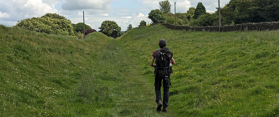
The wall part of Hadrian’s Wall is its most obvious feature. There was also a ditch on the north side as well as a mound/ditch/mound feature (the vallum) on the south side, all of which are still visible in sections. I personally found these as fascinating as the wall, but that might just be the former archaeologist in me! (The friend I hiked with wasn’t quite as enthusiastic about these lumps in the landscape.)
Today, the wall and associated structures are more than just ruins. They tell a story. I loved “standing watch” in turrets and imagining life on that northern frontier for units brought in from as far as modern-day Syria or Spain. I was fascinated by architectural details that reveal changes in plan (ie. going from a more ambitious, wide wall foundation to a “good enough” narrower base) and by artifacts like the Vindolanda tablets (including a birthday party invitation and a Roman cavalry officer’s note that “My fellow soldiers have no beer. Please order some to be sent.”). All in all, these historical touchpoints complement the walking part of the journey and make for a truly memorable experience.
THE TRAIL, MAPS & WEATHER
I used Henry Stedman’s guidebook to plan this trip and learn about sights along the way (details in Resources below). However, the trail is so well marked with National Trails’ acorn symbols that we rarely had to consult a map for route-finding along the way. Most days, you’ll walk over dirt trails that are easy on the feet and joints, interspersed with stretches along (mostly) quiet country roads.
I followed popular wisdom, which says west to east is preferable so that you have prevailing westerly winds at your back, and also for best views of the most spectacular landscape on days 3 and 4. The wind might not seem that significant, but I certainly noticed the chill and resistance it posed anytime I backtracked slightly west for a photo.
Summer is the obvious choice for Britain’s notoriously finicky weather. It’s also the high season, but we noticed only about 12-15 hikers heading east and an equal number heading west each day. The only exception was a busy stretch of trail around Sycamore Gap (day 4) where you’ll encounter a number of day trippers, but most don’t venture very far.
Carlisle weather forecasts proved accurate for the first half of the walk with Newcastle a good reference point for the second half. I hiked this trail in July 2024, and even when southern England was experiencing a heat wave of over 30°C/86°F, the highest temperature we felt in the north was 25°C/77°F. Throughout my entire ten day trip to southern Scotland/northern England, it rained for most of four days with fairer weather the rest of the time.
FOOD & ACCOMMODATION
The relative remoteness of the area means you’ll need to plan ahead carefully for food and accommodations if you want to avoid long detours away from the trail. Below, I describe food availability along the way, whether that’s pub grub or a store for picnic/self-catering supplies. Beware that you’ll need to pack a picnic lunch for days 1, 3, and 4 and that dinner options require forethought on days 3 and 5. I brought my own breakfast supplies (instant oatmeal) and picnic lunches (bread, cheese, sausage, dried fruit) for the entire hike, and paid for dinners every night.
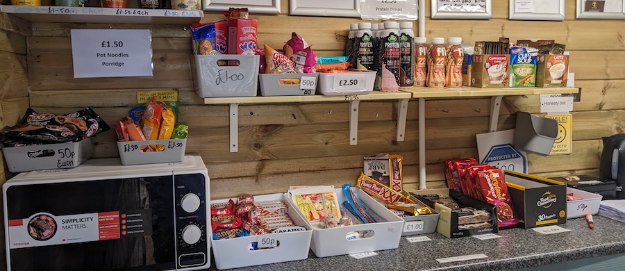
You will find honesty-system snack stalls every day. Some are incredibly well-stocked with everything from instant soups to microwave meals, though most only offer basics like fresh-baked goods and cold drinks. I recommend treating these as nice surprises rather than counting on them to sustain you.
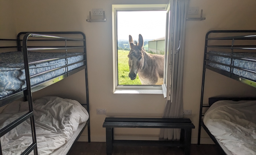
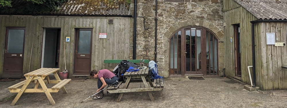
As in most places, hikers can choose between camping, hostel-style accommodations, and medium- to high-grade B&Bs. I mostly stayed in private hostels along the way (details in the daily descriptions below). We reserved well ahead of time for peace of mind and were glad we did, because most accommodations close to the trail are small, family-operated places that tend to book out.
All in all, the Hadrian’s Wall hike also proved to be a fairly inexpensive trip. My six days on the trail trip plus expenses over two extras days before/after the hike cost a total of about £420/€500/$540. That includes accommodations, meals (eating “in” for half the dinners and packing my own breakfast/picnic lunches), and train/bus connections to Edinburgh airport, but not including my flight to England).
ROMAN FORTS & RUINS
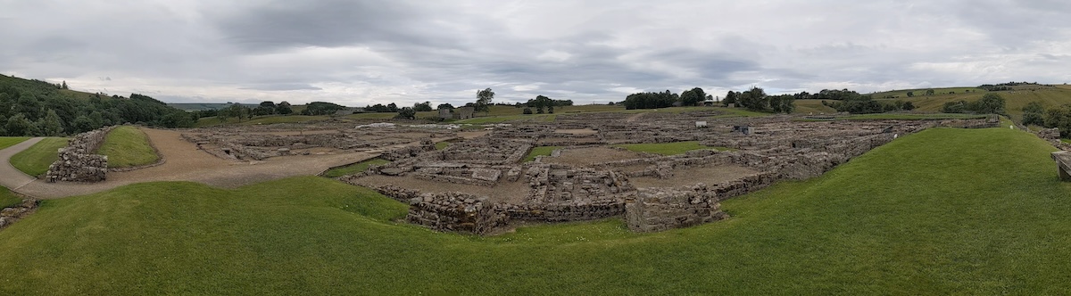
Hadrian’s Wall and all its associated smaller structures (milecastles and turrets) are free to visit and explore. You only need a paid ticket to visit the big forts. There were seventeen, but only a few are visible and open to visitors today. These are Birdoswald on day 3, Vindolanda on day 3 or 4, Housesteads on day 4, Chesters Fort on day 5, and Segedunum on day 6. Tickets to each site are £13.60 but you’ll save 15% if you book online a day before. As a former archaeologist, I wanted to visit every fort I could. If you’re less inclined to immerse yourself in all the details, I recommend visiting at least Vindolanda and either Housesteads or Chesters Fort.
DAY 1: BOWNESS-ON-SOLWAY to CARLISLE - 23km (14mi)
The walk begins in Bowness-on-Solway (not to be confused with Bowness-on-Windermere in the Lake District) on the Solway Firth (firth means inlet — in this case, a sharp dent in the coastline and an estuary of the River Eden). That’s Scotland you see on the north side of the inlet — but drink your fill of that view while you can, because the England/Scotland border runs sharply northeast from this point while Hadrian’s wall runs due east.
Bus 93 runs from Carlisle to Bowness, but I couldn’t find a connection that would bring me there at a reasonable time to start the hike in the morning. (Bus 93 overshoots Bowness on the way out to Anthorn, only calling in on Bowness on the way back to Carlisle. It’s that “way back” connection that’s the spoilsport here.) So, I ordered a taxi which took 25 minutes and cost £30. (Note: For this hike, I flew in to Edinburgh and took a train to Carlisle, where we booked a two-night stay and enjoyed day 1 of the hike with very light backpacks.)
Signs in Bowness point to the trail, where you’ll find a small shelter that marks the start/end of the trail. You’ll also find an ink pad and stamp here with which to mark your diary or the official Hadrian’s Wall Path stamp book, if that’s your thing.
Then, yay! You’re off on a flat, easy stage — the perfect way to settle into this week-long walk. I found this stage interesting thanks to wide estuary views withs lots of birdlife. In fact, we met a citizen scientist who has been recording bird sightings from “his” assigned section for the past 18 years!
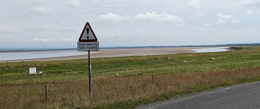
One section of road near Drumburgh is prone to flooding during very high tides so be sure to check the tide tables for Solway Firth ahead of time.
What you won’t find on this day is any trace of Hadrian’s Wall except for stones built into local buildings like the 12th-century St. Michael’s Church in Burgh-by-Sands. The church interior is interesting (look for the built-in defenses and a carved pagan god peeking out from behind the altar), and the shady bench outside is the perfect place for a picnic lunch. Tasty baked goods from the honesty box at the Methodist church in Port Carlisle rounded out my menu!
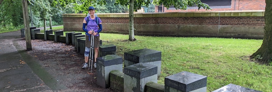
The only time you’re likely to consult your map on this day will be to check the route to your accommodation in Carlisle. This small city has a castle and two fun representations of Hadrian’s Wall: one is embedded in the sidewalk in front of the Tullie House Museum on Castle Street, and the other is a stylized 3D model of the wall and its major forts which you’ll find on the riverside trail just east of the A7/Eden Bridge. There are several big grocery stores in Carlisle — the only such conveniences along the entire trail until Newcastle.
- Food: picnic lunch; many dinner options in Carlisle.
- Accommodation tip: we booked two nights in Carlisle: the night before and the night of day 1, which allowed us to hike with light packs for the first day. I can highly recommend the lovely Cartref Guest House for a fairly upscale stay. There are many other options in town, however.
DAY 2: CARLISLE to WALTON - 19km (12mi)
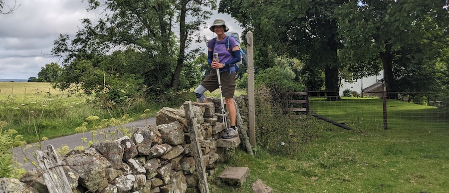
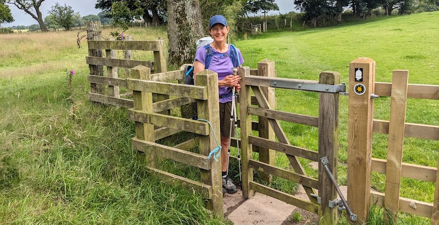
Day 2 is another easy day of countryside walking with many a stile and kissing gate along the way. Stiles are steps that take you over a stone wall; a kissing gate is a narrow gate that lets humans squeeze through while keeping livestock from roaming. We met one cute couple who kissed at every such gate — a nice way to mark progress throughout the day! You’ll also follow quiet back roads for portions of this day.
A historic marker at Bleatarn Farm points out traces of Roman earthworks at the halfway point of the day. Otherwise, there’s not much of particular interest along this leg — other than the amazing snack shed a kind soul/cunning entrepreneur set up in their front garden in Newtown. The covered picnic tables and cold drinks came at exactly the right time for us, as the only rain of our six-day walk set in here.
- Food: snack stands along the way; picnic lunch; order dinner at Florries.
- Accommodation tip: Florries on the Wall Bunkhouse turned out to be my favorite accommodation along this walk thanks to friendly owners, a comfortable common room, and a drying room for wet boots and clothing. Basic but filling dinners are available for £12-14 (spaghetti/chili/etc), and breakfast is included. We were the only two people in a very clean room with space for four and an ensuite bathroom (£40 per person).
DAY 3: WALTON to ONCE BREWED - 28km (18mi)
This leg covers a fair distance with a lot of ups and downs, especially over the final 10km. There’s lots to see, so history buffs will have to pace themselves. If you stop to see every small and big sight, you won’t reach Once Brewed in time for dinner. If you like a little down time in the late afternoon, you might have to make some strategic choices.
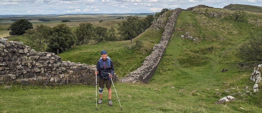
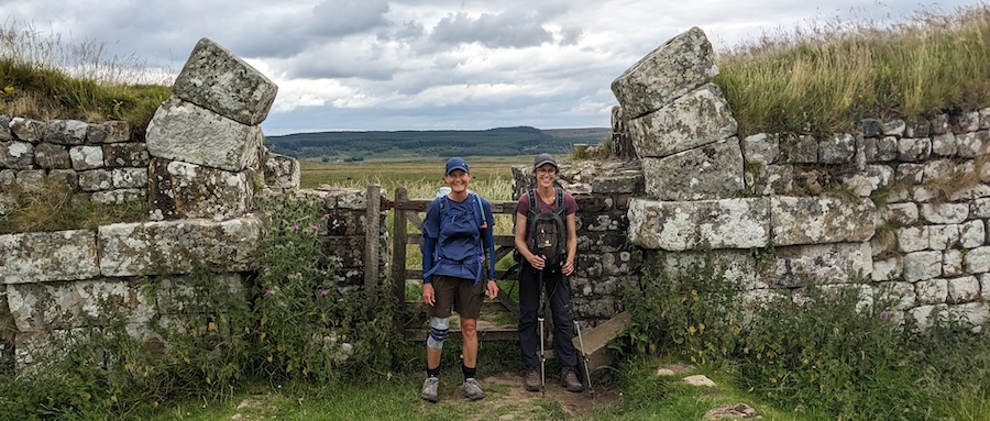
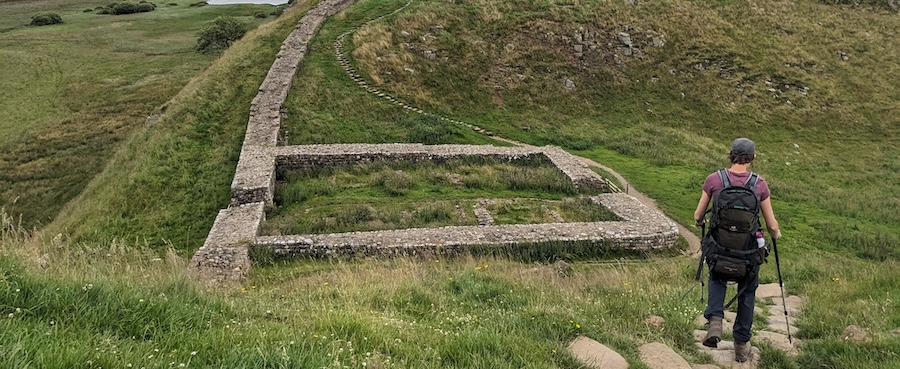
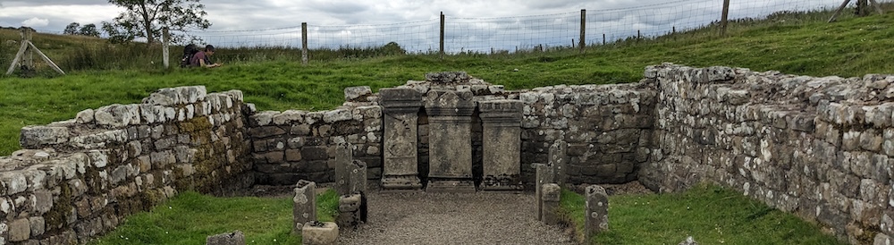
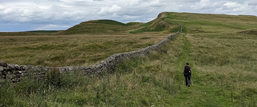
But, yay! Within the first half hour of hiking on this day, you’ll find your first big chuck of preserved wall, with many longer stretches to come, along with milecastles, turrets, and even a signal tower. Milecastles are small forts that were built every Roman mile along the wall. These protected gates through the wall and were manned by 20-30 soldiers. They are numbered from 1 in the east to 80 in the west (though not all are visible), so you’ll be counting down as you go. Between every two milecastles were two turrets — smaller lookout posts manned by about five soldiers. These turrets take the number of the nearest milecastle to the east with the letters A or B. Early in this day, you’ll come across your first well-preserved turret, 53B. One of many more to come!
I’ll leave it to the guide book to provide a blow-by-blow of this entire day. Suffice to say that you should plan 30-60 minutes to explore Birdoswald, the first major, visible ruins of a Roman fort. There’s a small exhibition space, the ruins with a gate and granary, and a café for hungry hikers.
Continuing downhill, you’ll drop into a serene, wooded valley, cross a river, and come across the ruins of Roman bridge, built and re-built in three major stages described on an information panel there. The keen-eyed hiker will notice that the wall goes from narrow to broader foundations after this point.
At about the 15km mark of this day, you’ll come to the ruins of 14th century Thirlwall Castle, and 1km later, cross a paved road. 200m to the right down that road is the Roman Army Museum, a great side trip for history buffs who wonder what life was like for a Roman soldier. If you’re interested, consider the discount combo ticket good for two days here as well as Vindolanda (see below).
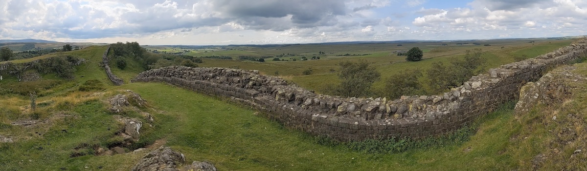
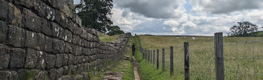
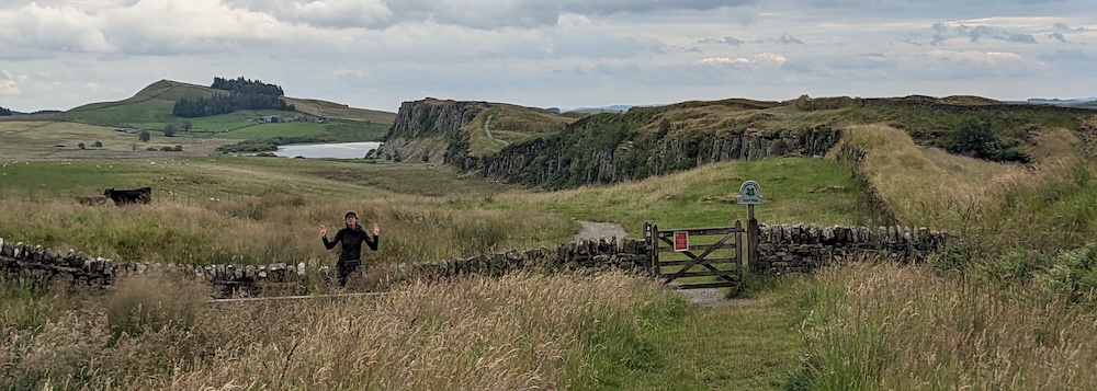
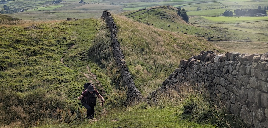
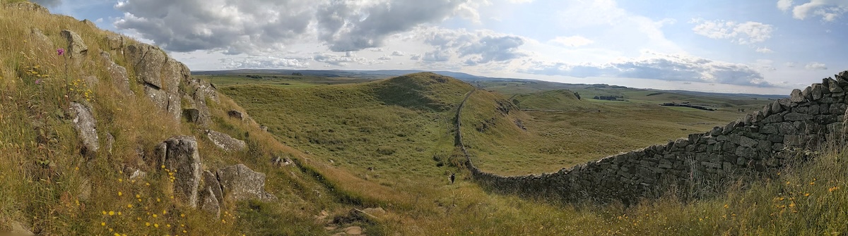
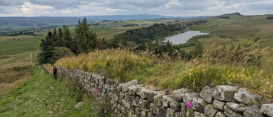
From the 15km point onward, you’ll dive into the most scenic portion of this entire hike along Whin Sill, a stunning, miles-long rocky outcrop that juts vertically out of the surrounding countryside. Each section has its own name, from the Nine Nicks of Thirlwal to Cawfield Crags and eventually Winshields Crags. Taking advantage of this natural barrier, the Romans continued their wall across every rise and dip of the landscape. Milecastles, turrets, views, and photo opportunities abound in the next few kilometers!
You’ll pass Great Chesters Fort along the way (free entry; not much visible here but there is an interesting altar at the back left corner), as well as a Roman quarry and eventually, the highest point of the entire trail (345m at Green Slack), marked by a small white obelisk.
Then, hooray! You’ll finally be in spitting distance of Once Brewed. Some guidebooks name Steel Rigg as the end point of this leg. That’s just a car park/scenic point along Hadrian’s Wall, a popular destination for day trippers with vehicles. Once Brewed is the hamlet half a kilometer downhill from the wall, where you’ll find a visitor’s center for Northumberland National Park called The Sill, the Twice Brewed Inn (great for dinner), and at first glance, not much else. However…
…only 2.6km (1.7mi) away, lies Vindolanda, one of the biggest, best excavated, and most important Roman forts in all of England. You can walk there in 35 minutes or catch one of the hourly buses from the bus stop at The Sill. The catch is, it’s “only” open from 09:30-17:30 in the summer (last entry time 16:30). That makes it hard to squeeze in a visit at the end of day 3, and it makes for a late start to day 4. The excavations and exhibits are world-class, however, so it’s really worth a visit (minimum 60-90 minutes). That’s one reason why day 4 is extra-short: to allow for a morning visit to Vindolanda.
- Food: snack stands along the way; picnic lunch or buy at Birdoswald fort café or the café in Gilsland; Twice Brewed pub dinner.
- Accommodation tip: We stayed in the basic Winshields Farm Bunkbarn for only £30 per person (including basic breakfast) and everything seemed fine…until one of us woke up to bed bugs. So, paying up for a room in the Twice Brewed Inn/pub might be a safer option.
DAY 4: ONCE BREWED to GREENCARTS - 17km (11mi)
This is another superlative day, and a short one to allow time to visit Vindolanda (see above). History buffs should consider scheduling a full layover day in Once Brewed to allow plenty of time to explore Vindolanda and The Sill, but “regular people” will probably find that a little too much time in this sleepy corner of England.
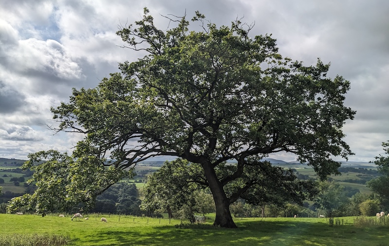
Setting off on day 4, you’ll pick up where you left off along the rugged, beautiful undulations of the Whin Sill ridgeline. Sadly, one of the first sights you’ll come to is the stump of the 200 year old sycamore tree at Sycamore Gap, famous for a short scene in the 1991 Robin Hood movie. Alas, this tree fell victim to a senseless act of vandalism that sparked outrage around the world.
Otherwise, you’ll tick off more milecastles and turrets, each as picture-perfect as the next, and walk along some of the longest, tallest remaining sections of wall. You’ll also cross the 400km, north/south Pennine Way early in the day. 6km into the hike is Housesteads Fort, one of the best-preserved and my top tip as “the” fort to visit if you’re not interested in seeing them all.
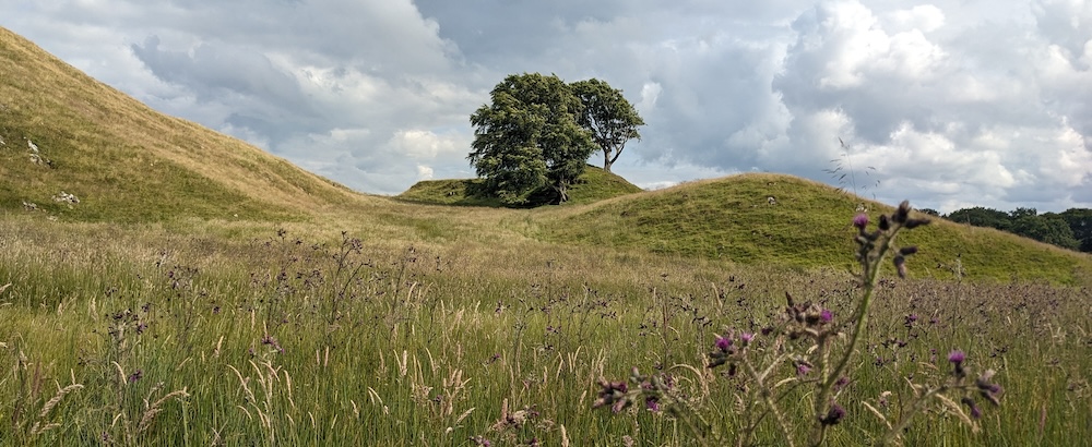
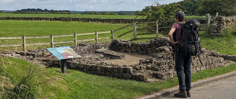
You’ll leave the most rugged part of the ridgeline behind at about the halfway point of this day’s hike. Only 2km from the day’s endpoint, you’ll reach the ruins of Brocolitia Roman Fort. There, only the unique Mithras Temple is visible — a quick, free, and interesting place to take a quick break.
I chose to end this day at Greencarts to keep this day’s distance relatively short and to take advantage of the budget bunkhouse there. If you’re looking for a different type of accommodation, continue another 5km to Chollerford.
- Food: snack stands along the way; picnic lunch or buy at Housesteads café; have dinner delivered to Greencarts.
- Accommodation tip: Greencarts Farm is a working farm, so it’s a little remote and the bunkhouse is fairly basic, but the family who runs it is very friendly and rooms are clean and inexpensive (£30 per person). There’s a self-catering kitchen or you can have reasonably priced pizza or Indian food delivered.
DAY 5: GREENCARTS to HEDDON-on-the-Wall - 26km (16mi)
The main sights and best scenery of this hike peter out over the course of this day, but it’s still pleasant enough with mostly easy going and a few points of interest to punctuate the day. Long stretches run parallel to a busy road, though well-preserved sections of the vallum (ditch) are a small compensation. However, I suppose it’s telling that one of the main highlights of this day is lunch or cake at Errington Coffee House in Port Gate (approx 13km into the day)!
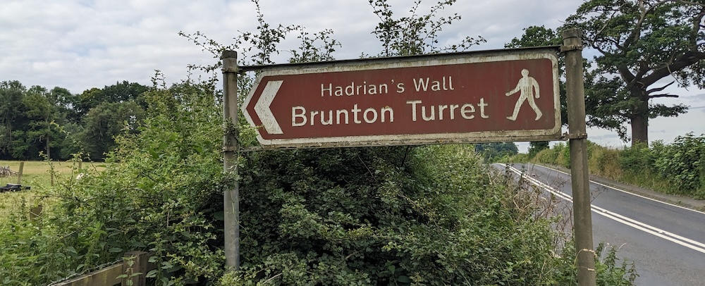
But first, approx 6km into the day, it’s worth making the signed 200m detour to see Brunton Turret where you can see the change in width of the wall — wider on one side of the turret and narrow on the other. (I imagine a centurion declaring “That’s good enough!”) Later, (approx 15km into the hike), you’ll pass Chesters Fort, with its baths, cavalry barracks, and a handy café. Another 1km farther along, Roman earthworks are especially visible on the right side of the trail.
Next, you’ll walk past Great Northern Lake, climb long, low Harlow Hill, and eventually walk past barely-visible Rudchester Fort (it was partly excavated, then covered up again). Finally, you’ll cross over the busy A69 to reach Heddon-on-the-Wall. Keep an eye out for a sign to the right for the Houghton North Farm shortcut if that’s where you’re staying.
- Food: picnic lunch or options to eat at Errington Coffee House in Port Gate, Robin Hood Inn (pub) in East Wallhouses; dinner at pubs in Heddon. Note: there is a mini Spar supermarket in the Heddon Shell station.
- Accommodation tip: We had a very comfortable stay in spic-and-span Houghton North Farm, which has a self-catering kitchen, a lounge room, and a pleasant courtyard (£40 per person).
DAY 6: HEDDON to NEWCASTLE/WALLSEND - 24km (15mi)
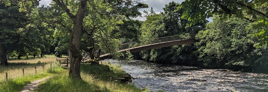
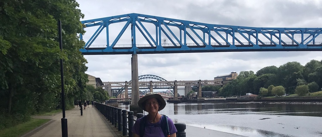
This day is totally different in that it drops down to the banks of the Tyne River and stays there for most of the day, offering totally different views and vibes than the rest of the trail — especially in the busy city center of Newcastle. There, a series of bridges help you tick off steady progress, and plenty of eateries will tempt you to take a break.
Things quiet down again as you exit Newcastle, and finally, you’ll find yourself on the home stretch to Wallsend. These last 3km of the trail are not as well marked as the previous 132km so you may need to consult your map from time to time.
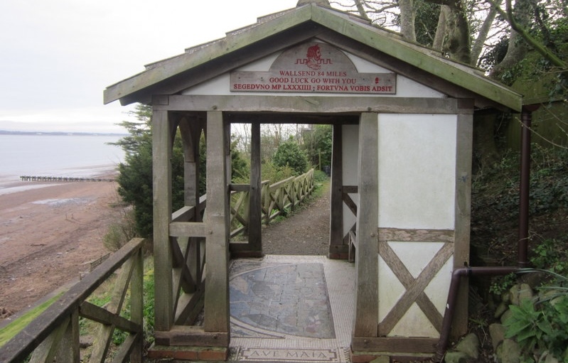
Hadrian’s Wall ends in — you guessed it — Wallsend, a suburb of Newcastle, where you’ll find the ruins of Segedunum Roman Fort. These are rather anticlimactic after the grander ruins of other forts. They were also fairly overgrown and neglected at the time of my visit. One thing Segedunum offers that no other fort does is a viewing tower that provides a great bird’s eyes perspective on the site.
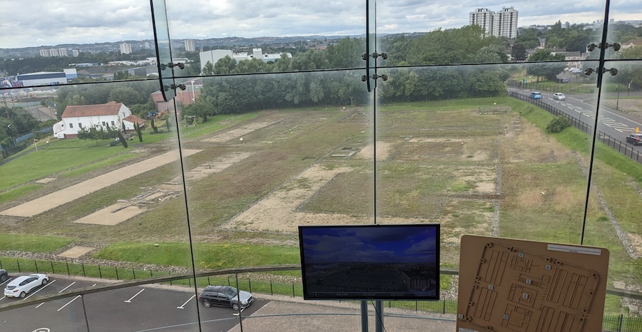
Wallsend metro station is only a few blocks away, with several trains an hour into Newcastle (20 min to Monument or St. James stations). However, if time and energy permit, consider taking the same metro line all the way (50 min) to South Shields to see Arbeia, a “supporting” Roman fort on the south side of the Tyne. You can be forgiven for thinking if you’ve seen one Roman fort, you’ve seen them all, because the Romans used a standard design for most of their major construction projects (not just here along Hadrian’s Wall but across the empire). However, Arbeia is unique in offering full-sized reconstructions of a Roman gatehouse, barracks and Praetorium (commanding officer’s house) that help you appreciate the ruins you’ve seen all along.
Although the official hike ends in Wallsend, some walkers continue another 8km to Tynemouth to complete a full coast-to-coast hike across Britain. A very tempting notion!
- Food: snack stands along the way; picnic lunch or many options in Newcastle.
- Accommodations: I hopped on a bus to Edinburgh right after hiking, but there are many accommodation options in Newcastle.
EQUIPMENT
I carried as light a load as possible in my 28L Deuter backpack. That included a rain jacket, a long undershirt, a warm long sleeve shirt, 1 extra shirt/underwear/socks, and a spare pair of pants.
I hiked in shorts/T-shirt with my wonderful new brainwave: bike leggings and arm warmers. I used the arm warmers every day, pulling them up in cooler, cloudy moments and back down when the sun peeked out or when I warmed up going up a hill. I highly recommend them!
The terrain along this trail isn’t rough or demanding, so high-top boots and hiking poles aren’t a must. I was very comfortable in my Merrill Moab low-top hiking shoes and thin socks. I did use poles but only because my posture is better when I walk with them and consequently my back is less tired at the end of a long day of walking.
Note: if you don’t want to carry a full pack, luggage transportation services are readily available. You’ll find plenty if you search for “Hadrian’s Wall luggage transportation services.”
RESOURCES
I used Henry Stedman’s Hadrian’s Wall Path guidebook in planning and hiking this walk. I found it heavy and overly detailed, with incredibly detailed maps — so detailed, they only cover about 8km (5mi) across a two-page spread. It took me a long time to get a hang for how to use this book without having my nose in the pages rather than my eyes on the scenery around me throughout the day. Another option is the Cicerone Guide which is slightly smaller but thicker than the Stedman guide. Both weigh in at a hefty 1kg (2.3 lbs).
This hike can certainly be divided differently. Independent hostels exist in various places along or near the wall, an excellent bargain option.
If you’re interested in brushing up your knowledge of Romans in Britain, I recommend the following documentaries/podcasts:
- Hadrian’s Wall 10 Places That Made England with Dan Snow is a good 5 minute intro to the wall with great aerial shots that help appreciate the scale of the forts.
- BBC In Our Time podcast on Hadrian’s Wall goes into depth on the wall, with both details and the broader context within the Roman Empire.
- BBC In Our Time podcast on Roman Britain is another informative program.
- Or check the English Heritage website for all things related to Hadrians’s Wall and its history.
Finally, I can recommend LJ Ross’ fictional DCI Ryan crime thriller series set in Northumbria. Book 1 is set on Holy Island (see below) and Book 2 around a fictional crime scene at Sycamore Gap.
THINKING BIG - ANTONINE WALL and HOLY ISLAND
There are no shortage of sights/destinations in northern England/southern Scotland to combine this hike with. History buffs will be interested to know there’s actually a second Roman wall in Britain — the Antonine Wall in southern Scotland, built twenty years after Hadrian’s Wall by his successor, Antoninus Pius.
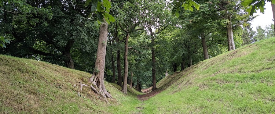
However, the “wall” there was a wooden palisade built upon a high embankment fronted by a deep ditch. That earthwork is the only part that survives today, leading some to quip that Antonine “Ditch” would be a more fitting name. Nevertheless, I found it fascinating and impressive, and I absolutely loved having the quiet, oak-lined “wall” to myself. The best-preserved sections can be found at Watling Lodge, Seabegs Wood, and Rough Castle. The latter is a 15 min. walk from the Falkirk Wheel, another interesting sight from a much more recent era!
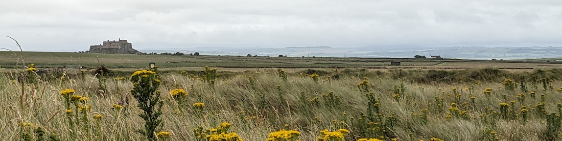
Another superlative destination in Northumberland is Lindesfarne/HOLY ISLAND, just off the east coast between Newcastle and Edinburgh and roughly a 90 minute drive from either city. It lies at the end of the St. Cuthbert’s Way six-day pilgrim trail. The island can only be reached at low tide when vehicles use a causeway while hikers walk directly across the sands — a unique and memorable experience.
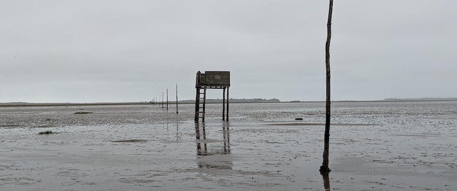
The only catch is timing the one-hour walk, but it’s not as tight as some make it out to be. We were able to set off one hour after the causeway opened to vehicles. On Holy Island, you’ll find the ruins of Lindesfarne Priory where the Lindesfarne Gospels (a masterpiece of medieval illuminated manuscripts) were written and illustrated. I’m simplifying for the sake of brevity here; suffice to say I highly recommend the walk and an overnight stay on Holy Island! I had a rental car, but you can also use public transportation to reach the starting point of the hike.
I hope this has been helpful and interesting, either as a planning tool or armchair adventure. For other exciting trips and ideas, click on “HOME” at the top of the page. Thank you for visiting TheTravelBug.blog and happy travels!